The BC River Forecast Centre says there could be a risk of flooding in the Quesnel area this weekend.
Dave Campbell, the head of the Centre, says it will come down to two things.
“The positive side is there is not an excessive amount of snow to come down, but really the concern is just that the rate that it’s anticipated to come down this weekend, so it’s a little bit of a balance of how quickly can we ring the water out of that snowpack, and the temperatures themselves.”
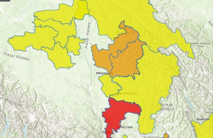
There is already a Flood Watch in effect for the Middle Fraser including the Cariboo Mountains and tributaries east of Quesnel, the Quesnel River, Moffat Creek, Horsefly, and areas around Likely, and water levels are expected to go even higher because of the unseasonably hot weather.
Campbell says they just don’t know by how much.
“I liken it to driving a car along and you put the pedal to the metal and you accelerate for a certain period but you don’t necessarily know what your top speed is going to be, so it’s a bit like that. We’ll definitely have the pedal to the metal this weekend with the melt, and at some point we’ll hit the maximum of what we can run off.”
Campbell says the melt was 2 to 3 weeks behind but that is no longer the case.
“We’ve seen a real flip in the last 10 days. We have really transitioned from that late melt to almost ahead of schedule now. That’s really driving what we’re seeing in high flows, just what has been an extremely rapid snow melt and obviously the concern is, with an even more intense hot spell coming at us, that is going to continue to accelerate the snow melt.’
Campbell says they’re not expecting any extreme flooding but he says localized flooding is a possibility.
Something going on in the Cariboo you think people should know about?
Send us a news tip by emailing [email protected].


