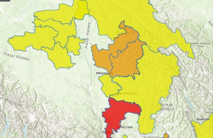
The BC River Forecast Centre has issued a Flood Watch for for the Middle Fraser including the Cariboo Mountains and tributaries east of Quesnel, the Quesnel River and Little Swift River and surrounding areas.
The surrouding areas would be Barkerville, Likely, Horseflly, Moffat Creek and the Cariboo River.
Meanwhile, the Fraser River mainstream including Quesnel, and the Middle Fraser plateau areas west of Quesnel, Williams Lake and Lhoosk’uz Dene, including Baker Creek, the Cottonwood River and the San Jose River, has now been downgraded to a High Streamflow Advisory.
The Nazko River and West Road River are also under a High Streamflow Advisory.
River and creek levels have been rising throughout the region due to the warmer weather and more hot weather is forecasted for this weekend.
Ministry of Forests
BC River Forecast Centre
A High Streamflow Advisory means that river levels are rising or expected to rise rapidly, but that no major flooding is expected. Fast-flowing bodies of water increase risk to life safety. Minor flooding in low-lying areas is possible.
A Flood Watch means that river levels are rising and will approach or may exceed bankfull. Flooding of areas adjacent to affected rivers may occur.
A Flood Warning means that river levels have exceeded bankfull or will exceed bankfull imminently, and that flooding of areas adjacent to the rivers affected will result.
Something going on in the Cariboo you think people should know about?
Send us a news tip by emailing [email protected].


