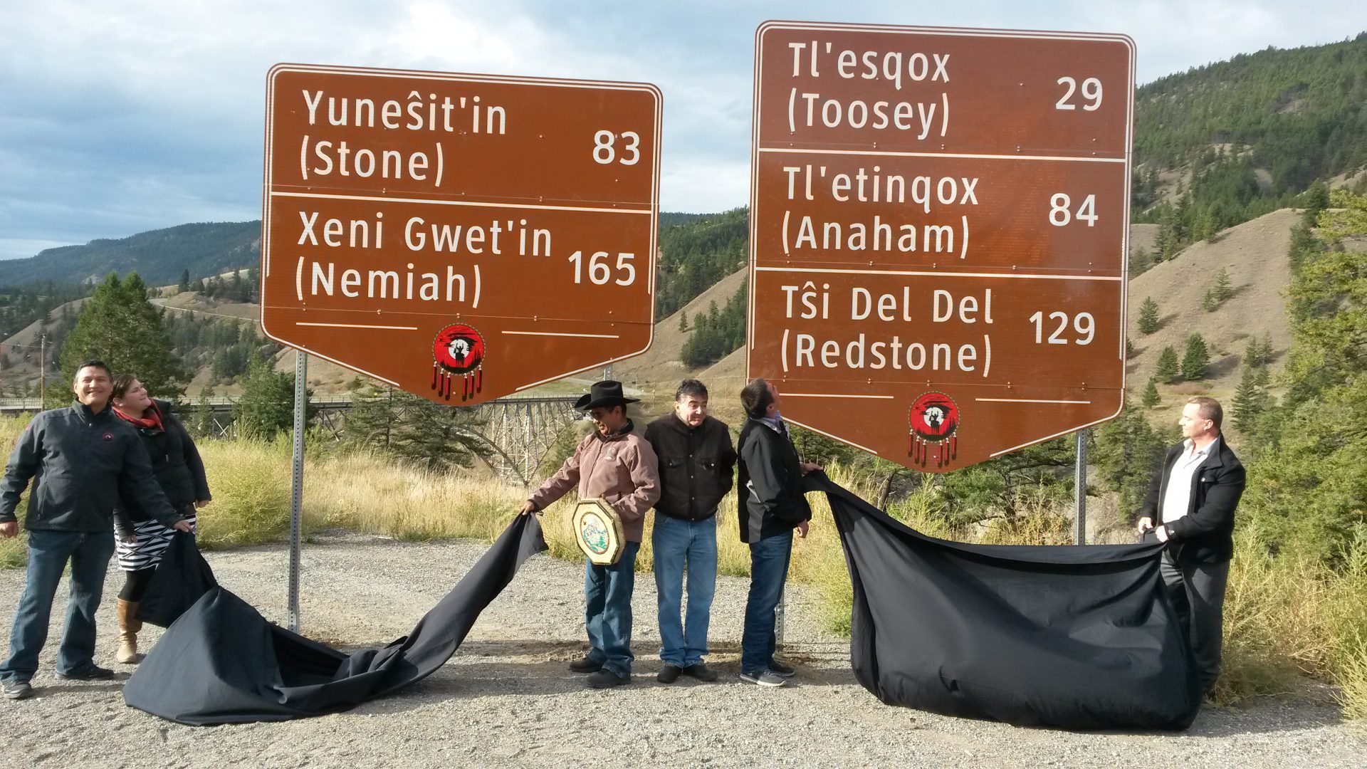
The first of many signs indicating the names of each Tsilhqot’in community and distance in kilometers as part of the provincial government’s reconciliation efforts with the Tsilhqot’in Nation were unveiled Friday morning.
Xeni Gwet’in Chief Roger William says First Nations have shown their presence in many different ways including fishing for salmon and hunting in the Tsilhqot’in Territory, and wagon trips.
He says he’s excited and calls it another important moment of recognition.
“I used to go to school on this road and our communities in their own language-where are they in terms of kilometers and now here they are,” he says.
“My children, our grandchildren, our future are going to the see the Tsilhqot’in and this is their Tsilhqot’in name.”
The two signs unveiled are set to go up near Pablo Creek Road with about 29 other signs to be installed along Highway 20 in the next several weeks.
William says there’s still a lot of things ahead that need to be worked on.
“We still have to sign a 5-year negotiations agreement-we’re thinking this late fall or early winter; we’re looking at the economics, we’re testing the water,” he says.
“We want to show some successes and this is part of the success. I think both of our communities, and for BC and Canada we need to show some success that this Title win is positive for this country, for this province, and I think here is a start.”
Signs advising motorists when they are approaching declared Tsilhqot’in Title Lands will also be installed.
“The highway and boundary signs visibly represent the Province’s recognition of the Tsilhqot’in communities and title land and contribute to our joint goal of lasting reconciliation,” says Aboriginal Relations and Reconciliation Minister John Rustad.
“We are building a strong relationship and actively working to finalize a comprehensive agreement that includes both economic and social priorities.”
The declared Tsilhqot’in Title Lands are situated east of Tatlayoko Lake around the north end of Chilko Lake—including the Nemiah Valley, Tsuniah Lake and along the Chilko River to its confluence with the Taseko River.
Something going on in the Cariboo you think people should know about?
Send us a news tip by emailing [email protected].

