The latest snowpack numbers released on Thursday (April 9th) for the Cariboo Mountains is quite high.
Dave Campbell is with the BC River Forecast Centre…
“We’ve done a separate analysis on the Quesnel system, Quesnel River, and its drainage which would more less include the Williams Lake area, and that’s at 132 percent of normal, so quite a bit higher.”
Campbell says the automated snow weather station at Yanks Peak remains at a record high of 153 percent of normal.
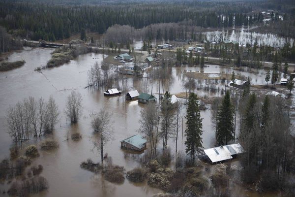
So should we be concerned about flooding this year ?
“As a general guideline for us, when we’re getting into that 110-120 percent of normal we’d be indicating probably a moderate risk in the flood risk, when we go over 120 percent that’s where we certainly get more concerned that that flood risk is definitely elevated, and then as we’re over say 135 percent is where I would really call the risk extreme or extremely high.”
Campbell says those numbers don’t tell the whole story though…
“When we see higher snowpacks the risk of flooding goes up but it’s not a crystal ball, it doesn’t mean that flooding is going to happen, it really does depend on how that snow melts. And do we get any additional significant rainfall during the snowmelt season, so both those things are really important factors to determine what we actually get for the season.”
The Fraser River typically peaks sometime between mid May and early June.
Something going on in the Cariboo you think people should know about?
Send us a news tip by emailing [email protected].


